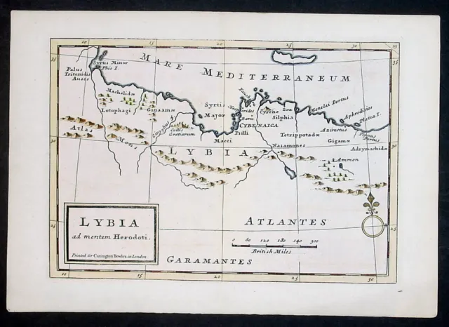
1764 Herman Moll mapa antiguo de Libia, norte de África
- contact us
- ebay profile
- ebay store
Lybia Cartographer : - Moll , Herman 1654 - 1732 - Date: - 1764
- Size: - 11in x 8in (280mm x 205mm)
- Ref#: - 32315-1
- Condition: - (A+) Fine Condition
- Date: - 1764
- Size: - 11in x 8in (280mm x 205mm)
- Ref#: - 32315-1
- Condition: - (A+) Fine Condition
Description: This original hand coloured copper plate engraved antique map of Libya North Africa by Herman Moll was published in the 1764 edition of Geographia Classica by Carrington Bowles (1724 - 1793). (Ref: M&B, Tooley)
General Definitions: Paper thickness and quality: - Heavy and stable Paper color : - off white Age of map color: - Original Colors used: - Yellow, blue General color appearance: - Authentic Paper size: - 11in x 8in (280mm x 205mm) Plate size: - 9in x 6 1/2in (230mm x 170mm) Margins: - Min 1/2in (12mm)
Imperfections: Margins: - None Plate area: - None Verso: - None
Background: Moll , Herman 1654 - 1732 Moll was a London cartographer, engraver, and publisher. Molls exact place of origin is unknown, although his birth year is generally accepted to be the year 1654. He moved to England in 1678 and opened a book and map store in London. He produced maps from his studies of the work of other cartographers. Due to Molls important work in Dutch cartography and the fact that he undertook a journey in his late years on behalf of the Netherlands, it is assumed he originated from Amsterdam or Rotterdam. The name, Moll occurred not only in the Netherlands however but also in the north German area, which may suggest a German origin. Dennis Reinhartzs biography assumed that Moll came from Bremen, and other more recent works assume Germany as well. Moll produced his earliest maps from studying cartographers such as John Senex and Emanuel Bowen. He probably sold his first maps from a stall in various places in London. From 1688 he had his own shop in Vanleys Court in Londons Blackfriars. Between 1691 and 1710 his business was located at the corner of Spring Gardens and Charing Cross, and he finally moved along the River Thames to Beech Street where he remained until his death. In the 1690s, Moll worked mainly as an engraver for Christopher Browne, Robert Morden and Lea, in whose business he was also involved. During this time he also published his first major independent work, the Thesaurus Geographicus. The success of this work likely influenced his decision to start publishing his own maps. In 1701 he published A System of Geography, the first of his own publishing. Although it contained no fundamental changes in the presentation of his previous work, it helped him to assert himself as a freelance cartographer. Over the years, the work itself as well as individual maps were of influence on other publishers, as they were frequently copied and re-issued. In the years that followed he brought out several volumes including Fifty-six new and accurate maps of Great Britain, a book of maps of the British Isles. Then came The Compleat Geographer which was an update to A System of Geography. He issued forty-two monochrome maps designed without the usual text, as by not using his usual colors he could produce them at significantly less expense than comparable works, and went through many new editions. In 1711 he began his Atlas Geographus, which appeared in monthly deliveries from 1711 to 1717, and eventually comprised five volumes. This included a full geographical representation of the world in color maps and illustrations. Molls subscribers. As with his earlier works, the Atlas Geographus was eagerly copied and imitated. In 1710 he began producing artfully crafted pocket globes . These were each a pair of globes, with the larger, hinged celestial globe encircled a smaller globe. On the latter he often included the route of Dampiers circumnavigation. These globes are very rare today. In 1715 Moll issued The World Described, a collection of thirty large, double-sided maps which saw numerous editions. In these maps Molls skill as an engraver is particularly clear. These were bound separately and then later sold in the form of atlases in a joint venture between a number of other publishers. The series included two of the most famous Moll maps: A new and exact map of the dominions of the King of Great Britain and To The Right Honorable John Lord Sommers...This Map of North America According To Ye Newest and Most Exact Observations. These were distinctive for their elaborate cartouches and images, and are known respectively as the Beaver Map and the Codfish Map. As with much of his work, Moll used these maps to publicize and support British policy and regional claims throughout the world. The Codfish Map shows in its cartouches a scene from the cod fisheries off Newfoundland. Since the beginning of the 16th Century the cod fishery there was an important economic factor for the European colonial powers. At the time of issue, the battle over fishing rights was one of the central points of contention in the North American policy of France and England. With its depiction of the processing of freshly caught cod for shipment to Europe, Moll highlighted for subscribers and viewers the importance of this sector for his native England. Moll labeled the Atlantic Ocean as the Sea of the British Empire and stressed that the British claims to fishing rights off the coast of Newfoundland. In a West India map from the same series, he wrote in the southwestern corner of Carolina, the words Spanish Fort Deserted and Good Ground. On many of its North American maps - including at the Beaver Map - he drew particular attention to major ports streets, because he knew that was a sufficient infrastructure detail, communicating that for the further expansion of English is very important. Pritchard argues that the Beaver Map was one of the first and most important cartographic documents relating to the ongoing dispute between France and Great Britain over boundaries separating their respective American colonies ... The map was the primary exponent of the British position during the period immediately following the Treaty of Utrecht in 1713. His maps were also used by other powers to attempt support for their claims. One of Molls maps of the island of Newfoundland, published in the 1680s, showed Pointe Riche, the southern limit of the French Shore to be situated at 47°40 north latitude. In 1763 the French attempted to use this map to establish their claim to the west coast of Newfoundland and Labrador, arguing that Point Riche and Cape Ray were the same headland. Governor Hugh Palliser and Captain James Cook found evidence to refute Molls claim and in 1764 the French accepted the placement of Pointe Riche near Port au Choix. However, all political considerations aside, Molls maps were in his lifetime and after very influential, and are still among the most sought after aesthetic engravings in the history of cartography. Moll was quite involved in the contemporary intellectual life. He was friendly and acquainted with Robert Boyle, Robert Hooke and William Dampier, both socially and likely through the Royal Society. His relationship with Dampier, especially, was mutually very beneficial. Moll had access to the latest data and observations from Dampiers many voyages, allowing his to be the first to accurately portray the great ocean currents, and Dampier in turn had his best selling books illustrated by Moll. Daniel Defoe was another contemporary with whom Moll exchanges ideas, and for whom he provided illustrations and maps. Another acquaintance, Jonathan Swift, went so far as to include him in his famous book, Gullivers Travels, having Lemuel Gulliver remark in chapter four, part eleven: I arrived in seven hours to the south-east point of New Holland. This confirmed me in the opinion I have long entertained, that the maps and charts place this country at least three degrees more to the east than it really is; which I thought I communicated many years ago to my worthy friend, Mr. Herman Moll, and gave him my reasons for it, Although he has rather chosen to follow other authors. Moll died on 22 September 1732, as noted in his obituary in Gentlemans Magazine. Please note all items auctioned are genuine, we do not sell reproductions. A Certificate of Authenticity (COA) can be issued on request. What is an Antique MapThe word Antique in the traditional sense refers to an item that is more than a hundred years old. In the past maps were sold in two forms, as a single sheet (broadsheet) or bound in an atlas or book. The majority of antique maps for sale today come from books or atlases and have survived due to the protection offered by the hardback covers.
When considering a purchaseThe first thing to determine when staring a collection or purchasing an item, is what is important to you. Most collectors prefer to build their collections around a theme. You may decide to collect maps from one region or country, charting its development through time. Similarly you could collect maps of one particular period in time, by type (i.e. sea or celestial charts) or by cartographer. The collector might also want to consider the theme of cartographical misconceptions such as California as an island or Australia as Terra Australis or the Great Southern Land. The subject is so wide that any would-be-collector has almost endless possibilities to find his own little niche within the field, and thereby build a rewarding collection.
Starting a collection & pricingPricing is based on a number of different factors, the most important of which is regional. In any series of maps the most valuable are usually the World Map and the America/North America. The World because it is usually the most decorative and America because it has the strongest regional market. Other factors that come into play re: price is rarity, age, size, historical importance, decorative value (colour) and overall condition and quality of paper it is printed on. As specialised dealers, we frequently work with first time map buyers who are just starting their collection. Guiding new collectors on their first antique map purchase and helping new collectors to focus their interests is one of the most rewarding aspects of being an rare map dealer. So please do not hesitate to contact us and we will be happy to help with any questions you may have.
Payment, Shipping & Return OptionsPlease click on the "Shipping and Payments" Tab above for shipping, payment and return details
About USClassical Images was founded 1998 and has built an excellent reputation for supplying high quality original antiquarian maps, historical atlases, antique books and prints. We carry an extensive inventory of antiquarian collectibles from the 15th to 19th century. Our collection typically includes rare books and decorative antique maps and prints by renowned cartographers, authors and engravers. Specific items not listed may be sourced on request. Classical Images adheres to the Codes of Ethics outlined by the Antiquarian Booksellers Association of America (ABAA). We are a primarily an online based enterprise, however our inventory may be viewed by appointment. Please call or email to arrange a viewing.
- Cartographer/Publisher: Herman Moll
- Printing Technique: Copper Plate
- Original/Reproduction: Antique Original
- Format: Atlas Map
- Type: World Atlas
- Year: 1764
- Date Range: 1700-1799
- Country/Region: Libya
PicClick Insights - 1764 Herman Moll mapa antiguo de Libia, norte de África PicClick Exclusivo
- Popularidad - 0 seguidores, 0.0 nuevos seguidores por día, 557 days for sale on eBay. 0 vendidos, 1 disponible.
- Mejor Precio -
- Vendedor - 5.981+ artículos vendidos. 0% votos negativos. Gran vendedor con la regeneración positiva muy buena y sobre 50 calificaciones.
La Gente También Amó PicClick Exclusivo
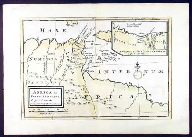
1764 Herman Moll Antique Map of Tunisia & Libya North Africa, Carthage
EUR 59,14 ¡Cómpralo ya! 21d 9h
MOROCCO, NORTH AFRICA, SAHARA, GIBRALTAR, original antique map, Bellin, c.1764
EUR 60,87 ¡Cómpralo ya! 18d 8h
Ancient North Africa Libya Herodotus Berenice Tripoli 1735 Moll engraved map
EUR 58,67 ¡Cómpralo ya! 13d 21h
Libya North Africa Benghazi Tripoli Berenice 1936 large Italian map
EUR 43,02 ¡Cómpralo ya! 13d 16h
ALGIERS, NORTH AFRICA, ALGERIA, original antique map, Bellin, c.1764
EUR 73,05 ¡Cómpralo ya! 18d 8h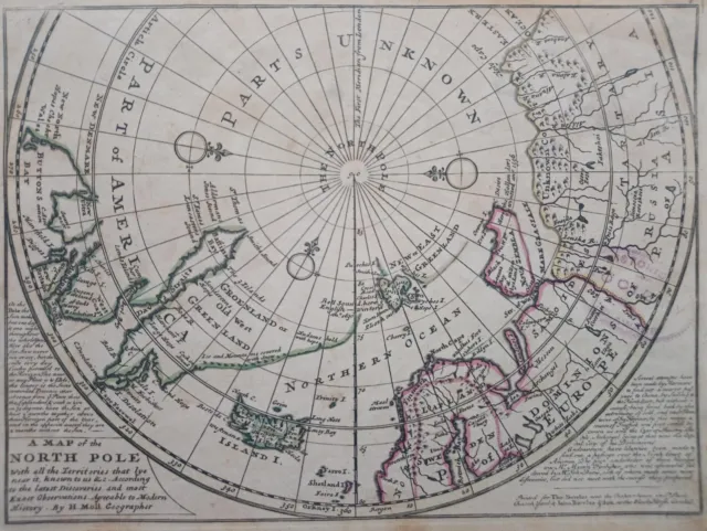 1 seguidor
1732 Herman Moll Mapa Polo Norte Map of the North Pole with all the territories
EUR 280,00 ¡Cómpralo ya! o Mejor oferta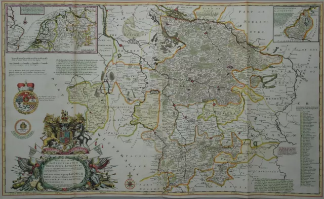
Ducado Braunschweig - Lüneburg De Herman Moll - Talla, Raro Mapa - 1720
EUR 1.129,71 ¡Cómpralo ya! o Mejor oferta
